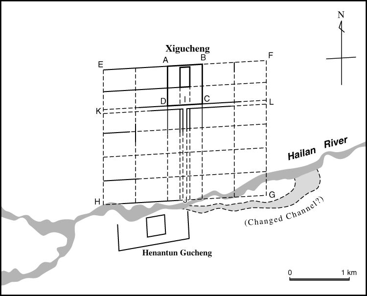

Fig. 4: Reconstruction of the plan of Zhongjing Xiandefu
Drawn by the author based on interpretations of CORONA Satellite photos. Solid lines denote evident linear feature on the satellite photos. Broken lines denote imaginary grid of the plan. Geometric distortion is included.