![]()
Geographic Data Processing — Examples of Computer Programming in C++
Noboru Ogata (Kyoto University)
The following are the examples of computer programming for geographic data processing. To simplify the programming, the examples are implemented as console applications. Students can study the principles of geographic data processing by inspecting source codes presented here.
Example 1 — Geomorphometric Analysis ... Updated!
|
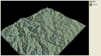
Extracted ridge lines from the terrain model |
Example 2 — Network Analysis Based on the Graph Theory
|
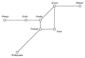
Hypothetical railway network |
Last Updated: 12/Jul/2010
![]()
![]()