Kyoto through the Ages

Capital of Japan for a Millenium


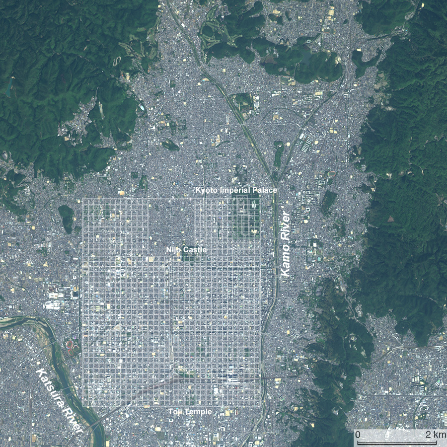
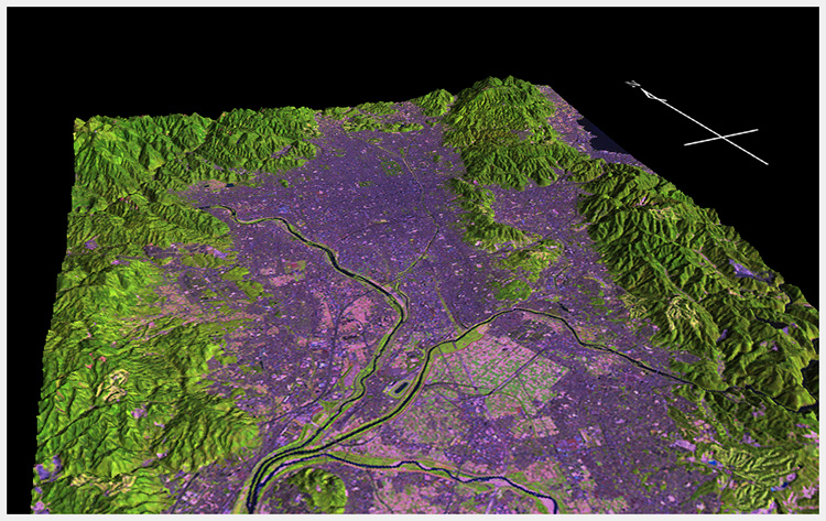
Synoptic view of the topography of Kyoto. The edict decreeing the transfer of the capital to Kyoto issued in 794 stated that this location “is guarded by mountains and rivers just like collars and sashes”. Digital Geomorphological Data (DEM) are supplied by the Geospatial Information Authority of Japan, and satellite image is of LANDSAT taken on October 15, 2001.


Due to the retirement of the website administrator, this site was moved from Kyoto University to «http://kyotohumanities.jp/KyotoHistory/». (May 11, 2023)


Kyoto was the capital of Japan from 794 to1869. Although the political center had been at Kamakura during the Kamakura period (1185-1333), Kyoto continued to be the largest city and the center of economy and culture. During the Edo period (1603-1868) when Edo (modern-day Tokyo) was the political center and Osaka became important economically, Kyoto continued to hold a prominent position in manufacturing and culture. Kyoto has a rich cultural heritage that includes Buddhist temples and Shinto shrines. Historical monuments of ancient Kyoto were mentioned on the World Heritage List of UNESCO in 1994. This website guides you on a tour of the history and geography of Kyoto based on primary sources. Graphics such as maps, aerial photographs, and satellite images are used in the descriptions.

Overview

Satellte image of Kyoto. SPOT 7 (2016/05/01) true color image (©Airbus DS 2016). The grid plan of the ancient capital, Heian-kyo, is overlaid.

You can choose the following descriptions by time.


Map of Kansai district of Japan showing the geographical context of Kyoto

Data Source: digital elevation data and digital land use data provided by the Geospatial Information Authority of Japan

Processed and visualized by Noboru Ogata.


This website Kyoto through the Ages is maintained by Noboru Ogata, Professor Emeritus, Kyoto University.

Since : March 30, 2018   Last updated : May 11, 2023