![]()
By Noboru Ogata
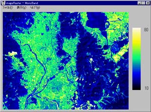 MonoBand.exe
Handles single waveband from satellite image
data for displaying. It can also display
results of simple filtering processes such
as edge enhancement.
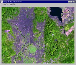 FalseColor.exe
Reads three wavebands from satellite image
data for displaying them in a composite false
color image.
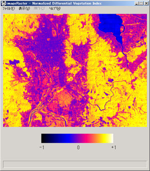 Ndvi.exe
Reads visible waveband and infrared waveband,
calculates normalized vegetation index (NDVI)
and then displays it in a pseudo color image.
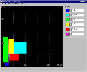 BiLevelSlice.exe
Reads two wavebands and uses them for land
cover classification. It is done by displaying
two dimensional histogram for any rectangular
area in a satellite image and setting a rectangular
region in the pixel-value space to set corresponding
land cover category.
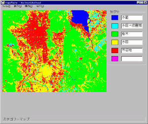 MaxLike.exe
Reads two wavebands and uses them for land
cover classification using maximum likelihood
method. It is done by selecting training
areas representing typical land cover categories
in a satellite image.
The above LANDSAT TM data over the Kyoto
Basin was received and processed by NASDA and distributed by RESTEC. |
![]()