![]()
Landscapes of the Kyoto Basin — Displays using mapRaster2
Noboru Ogata
Kyoto, the ancient capital of Japan where our university is located, is in a basin surrounded by mountains in three directions except the south. In this page we show bird's eye images created from digital elevation data (DEM) with other geographical sources using mapRaster2.
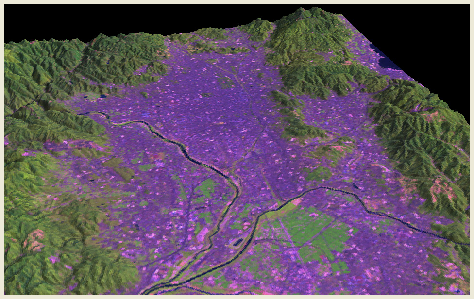 Satellite
Imagery (Landsat 7 ETM+: August 25, 2000)
Satellite
Imagery (Landsat 7 ETM+: August 25, 2000)
Earth observation satellite imagery of LANDSAT 7 is draped over the surface
model. The satellite data was received by JAXA
Japan and distributed by RESTEC
Japan.
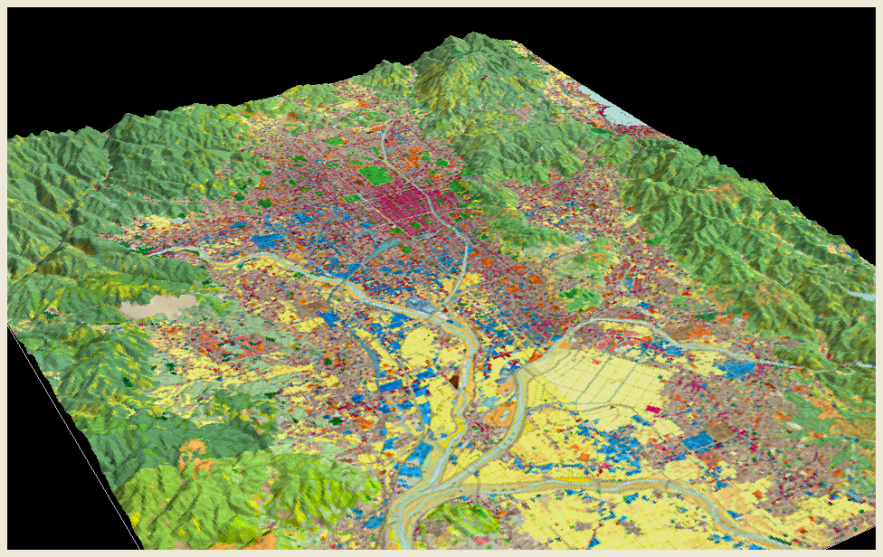 Land
Use Map
Land
Use Map
Land use maps published by the Geographical
Survey
Institute of Japan in the 1980's are draped over the surface model. Different
categories of land uses are shown in colors. Although the sources maps are somewhat
old, we can see that industrial areas shown in blue are mainly located in the
western and southern part of the city of Kyoto.
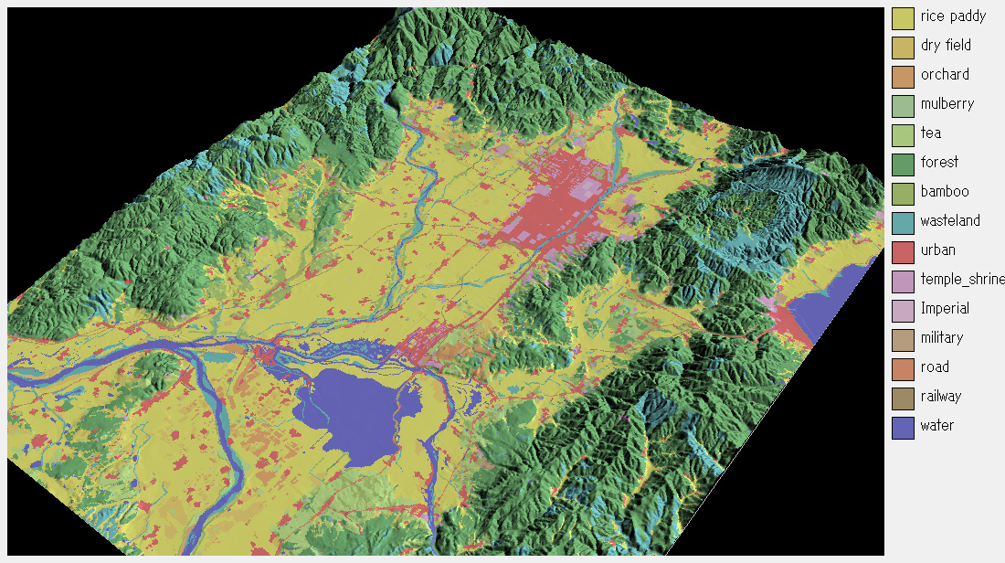 Kyoto
in the late 19th century
Kyoto
in the late 19th century
Land use classification based on the maps made by the Japanese army around 1890 are draped over the surface model These maps are among the first works utilizing modern cartography. The image reflects pre-modern situation of the city of Kyoto. Kyoto served as the capital of Japan for a long period of history, so the picture shows highways extending in all directions (for example, the Tokaido highway to the east and the San’indo highway to the west).
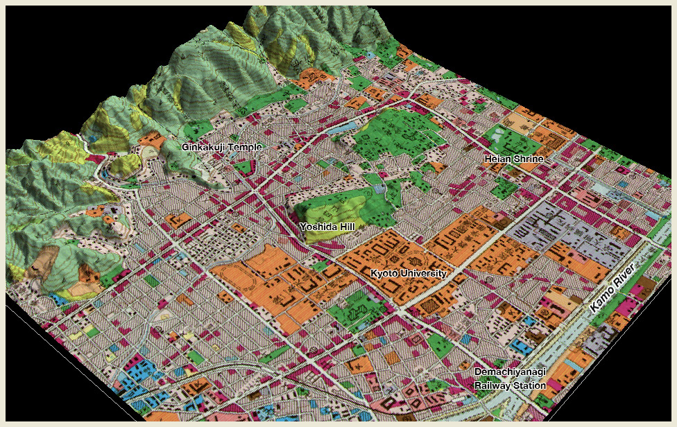 The
neighborhood of Kyoto University
The
neighborhood of Kyoto University
Using high resolution (5 meters) digital elevation data, this image shows
the neighborhood of our university in the northeastern part of Kyoto.
Land use map is draped over the surface model, and the category of
educational institute is shown in orange. Tourist spots such as Heian
Shrine and Ginkakuji Temple are also in this area.
 Geomorphologic
analysis of the neighborhood of Kyoto University
Geomorphologic
analysis of the neighborhood of Kyoto University
The Kyoto Basin is made of alluvial fans formed by many streams flowing
from the surrounding mountains. By exaggerating the elevation by eight-fold
and colored by elevation, we can see two major alluvial fans (shown
in yellow) in the area. The larger one on this side, where our university
is located, is the fan deposited by Shirakawa River. We can also find
an active fault running through the area.
![]()