![]()
Noboru Ogata (Professor Emeritus, Kyoto University)
In this web page, we offer the record of the research trip made in the Samarkand region, Uzbekistan in August 2000 as a part of the research project sponsored by the Research Center for Silk Roadology. The purpose of the study was to find the ground truth about the archaeological features identified on the intelligence satellite photographs taken in 1964. We visited a number of sites guided by the local partners, and found that those features identified on the satellite photographs were ruins of ancient settlements and forts. The results of the research project were published in the Bulletin of the Research Center for Silk Roadology Vol. 17 (2003) "A Study on Cities, Settlements and Archaeological Sites in the Silk Road Region Using Satellite Photos."
Study Area
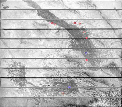
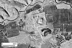
The left picture is the intelligence satellite (CORONA satellite) photographs taken by the United States on October 20, 1964. It covers the Zarafshan River Basin (upper part) including Samarkand and the Kashka River Basin (lower part) including Shakhrisabz. Those basins (oases) look dark among the dry region which looks bright on the photograph.
Red circles in the photograph denotes archaeological sites we visited while blue squares show the location of major cities.
Samarkand occupied important position in the Silk Road region throughout the historical ages. The troops of Alexander the Great from Greece reached this region in the 4th century BC. Xuanzang, a Buddhist priest from China who traveled to India in the 7th century AD, wrote in his record that Samarkand is located in the middle of the western regions. In the 15th century Samarkand enjoyed its heyday as the capital of the Timurid Empire.
| August 25 | We traveled from Samarkand southward and visited several archaeological sites near the edge of the basin. |
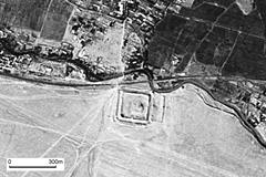
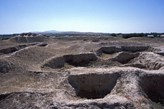
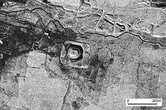
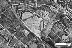
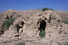
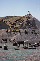
| Qofur Kala ... City ruins with a citadel and several towers. | ||
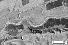
 |
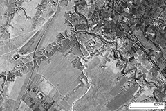
CORONA satellte photograph over Qofur Kala,
Gisht Tepa and Dunyo Mirzo Tepa |
|
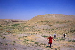
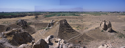
| Panoramic view from top of the citadel
including three towers |
 |
 |
 |
|
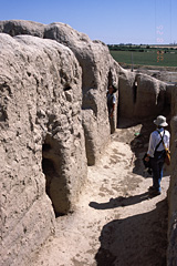
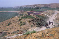
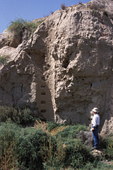
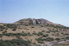
| Dunyo Mirzo Tepa ... We found remains of
a well with footholds inside on the side of the mound. |
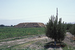
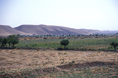
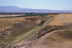
| Small unnamed mounds scattered in the field | 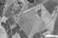 |
CORONA satellite photograph showing
small mounds scattered in the field
|
 |
 |
|
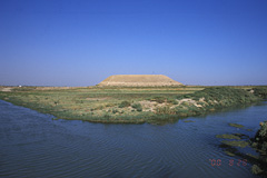
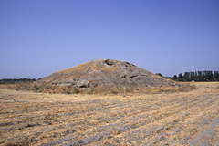
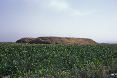
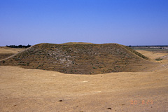
Prismoid shaped small mound |
| August 26 | We traveled from Samarkand westward along the southern edge of the basin and visited several archaeological sites. |
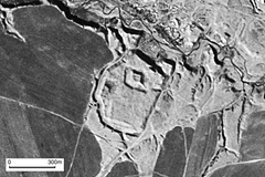
| Robinjon Tepa ... The site had been destroyed by the construction of a new irrigation canal. | ||
 |
Robinjon Tepa on the CORONA satellite
photo taken in 1964 |
 |
| August 28 | We traveled northward from Samarkand and visited Kok Tepa and other archaeological sites. |
| Kok Tepa ... The most important archaeological site of an ancient city in the Samarkand region except for Samarkand itself. We heard that, in the recent excavations of the site, archaeologists found a bronze mirror from Han Dynasty China. |
| Kok Tepa on the CORONA satellite photograph |
 |
 |
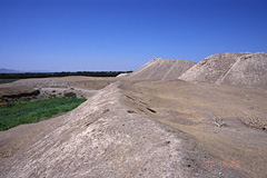
The citadel of Kok Tepa having trenches for archaeological digs |
 |
| Qorovul Tepa ... We heard the name means 'beacon hill' | ||
 |
Qorovul Tepa on the CORONA satellite
photograph |
 |
| August 29 | We traveled southward across the mountain to reach Kashka river basin and visited Chimqurgon Tepa. |
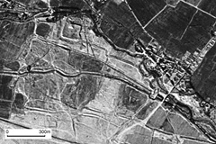
| Chimqurgon Tepa ... A huge fort with double enclosure | ||
 |
Chimqurgon Tepa on the CORONA satellite
photograph |
 |
 |
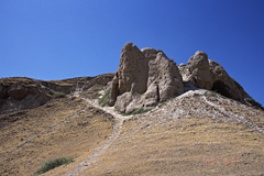
Inner enclosure of the fortifications |
 |
Created by Noboru Ogata
Since 01/Aug/2006
![]()
![]()