|
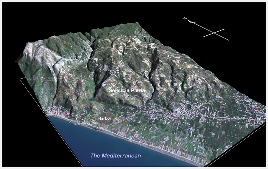
| Geomorphological model of Seleucia Pieria. This is based on the high resolution digital elevation data «AW3D», which was created using the observation of Japan’s earth observation satellite ‘DAICHI’. Satellite image draped on the model was taken by SPOT7 on November 13, 2015. |
AW3D™ topographic data are created based on the observation of Japan’s satellite DAICHI operated by JAXA.