 |
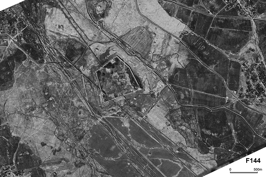
| CORONA Satellite Photograph over Er Kurgan (October 20, 1964). This archaeological site is apparently composed of pentagonal city wall. We can observe a citadel on its north side. The closer look at the photo reveals existence of a trace of moat outside the wall and also outer enclosure. This site is particularly complex in composition. The local archaeologist explained that the site dates back to the 7th century BC. We can also see many tepas around the site. |
CORONA satellite photographs are available from U. S. Geological Survey, EROS Data Center, Sioux Falls, SD, USA.