Noboru Ogata (Professor Emeritus, Kyoto University)
This webpage offers the records taken during our research trips in the Samarkand region, Uzbekistan, in November 2013 and September 2015. The research trips were made as parts of our research project on the Eurasian historical cities funded by the grant of the Ministry of Education. Based on preliminary survey using satellite imagery, we visited the settlement ruins near Samarkand and specifically in the Kashkadarya Basin.
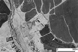
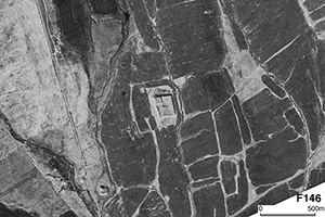
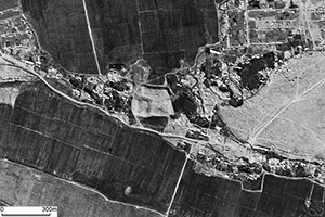
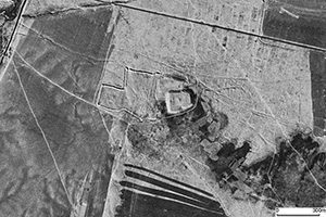
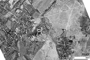
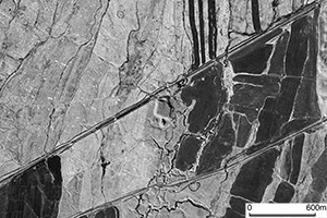
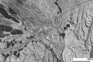
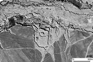
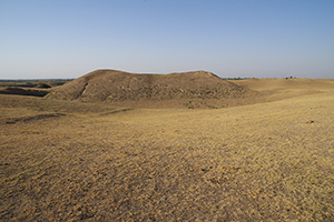
On the CORONA satellite photograph taken in the 1960’s, we can find lots of archaeological features. These are settlement ruins mostly taking the form of ‘tepa’, an artificial mound. These mounds are accumulations of artifacts such as mud bricks and ceramic pieces, and comprise chronological stratifications. Tepas can be considered equivalent to ‘tells’ in the Middle East.We observed that tepas in the study area have distinct hight, the citadel, and surrounding moat.
We also inspected urban remains composed of city walls such as Er Kurgan and Odirma Shahar on site. These city ruins are particularly old, dating back even Achaemenid and Hellenistic periods respectively. Along with many observations of tepas, knowledge about these city ruins will contribute to our morphological and genealogical study of Eurasian historical cities.
In this webpage, we refer to the higher part of a tepa as ‘citadel’, and to the other part as ‘shakhristan’ etc. However, these morphological terminology of the parts of settlement ruins is just temporary, and not necessarily based on a consistent model. The relationship of ‘moats’ with the settlement ruins is still not established. It is the future task of our research to establish models and categorization on the morphological elements with regard to tepas and other settlement ruins.
The results of our study are published in the folloing articles. A research project in the similar framework was done in August 2000.
- Noboru Ogata (2014) Study of distribution and form of the settlement remains in Central Asia: Resuts of the research trip in Uzbekistan in 2013, Region and Environment No. 13, pp. 109-120 (in Japanese).
- Noboru Ogata (2016) Study of distribution and form of the settlement remains in Central Asia (2): Resuts of the research trip in Uzbekistan in 2015, Region and Environment No. 13, pp. 109-122 (in Japanese).
[References]
- Uno, T. and Amridin, B. (2013) Tha Site of Kala-i Dabusia: Sogdian City along the Silk Road: Archaeological Research of City Centers of Central Asia.
- Abdullaev, K. and B. Genito (2014) The Archaeological Project in the Samarkand Area (Sogdiana): Excavations at Kojtepa (2008-2012), Universita Degli Studi di Napoli "l'Orientale" Dipartimento Asia, Africa e Mediterraneo; Institute of Archaeology of the Academy of Science of Uzbekistan; Series Minor LXXIX.
 |
| Synoptic view over the study area using LANDSAT image (TM : July 25, 1988 / August 4, 1991). Irrigation areas of Zerafshan River (North) and Kashkadarya River (South). |
November 17 : Departed Kansai (Osaka) airport and flew to Tashkent via Incheon.
November 18 : Traveled from Tashkent to Samarkand. We visited Kanka archaeological site on the way.
 |
 |
|
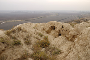
Citadel and moat of the Kanka site |
 |
 |
|
Eastward view from the citadel |
November 19 : After visiting Archaeological Institute of Uzbekistan in Samarkand, we traveled to Shakhrisabz. Then we visited archaeological sites in the Kashkadarya region, some of which are located on the alluvial fan of Karasu river. Stayed in Samarkand.
 |
 |
|
Kush Tepa |
 |
 |
|
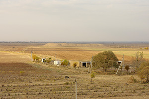
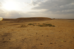
Yalpok Tepa viewed from Kush Tepa |
 |
 |
|
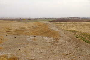
Southward view from the citadel of Yalpok Tepa |
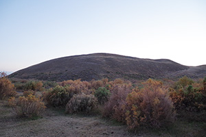
November 20 : We went around the Kashkadarya region and visited a few archaeological sites. Firstly we visited Odirma Shahar. The description about this site is given below in the record of our visit in 2015. The we visited Kara Tepa and Komay Tepa. Stayed in Samarkand.
 |
 |
|
Citadel of Kara Tepa |
 |
 |
|
Komay Tepa |
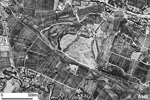
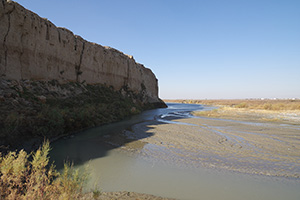
November 21 : Visited Kok Tepa and Dabusia site in the Zerafshan river basin. We took dinner with the local people in an Islamic mausoleum near the Dabusia site. Stayed in Samarkand.
 |
 |
|
Kok Tepa in the cotton field |
 |
 |
|
Dabusia archaeological site |
 |
 |
|
Trench of the Dabusia site |
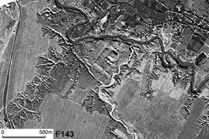
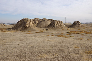
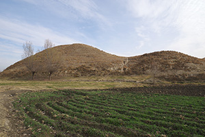
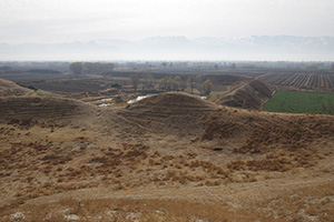
November 22 : Visited archcaeological sites of Kafir Kala and Kuldor Tepa, which lie in the Zerafshan river basin. I (N. Ogata) visited Kafir Kala during the research trip in August 2000. Stayed in Samarkand.
 |
 |
|
Kafir Kala |
 |
 |
|
Citadel of Kuldor Tepa |
 |
 |
|
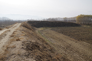
Enclosure of Kuldor Tepa |
November 23 : After seeing the sights in Samarkand, we traveled to Tashkent. Stayed in Tashkent.
November 24 : Visited National Museum of History. In the evening we departed Tashkent to go home.
September 20 : Departed Kansai (Osaka) airport and flew to Tashkent via Incheon. September 21 : After visiting the Museum of the National Academy of Science, we travelede to Samarkand. Then visited Kafir Kala. September 22 : Visited the Historical Museum in Samarkand.
September 23 : Traveled from Samarkand to Karshi, we visited archaeological sites in the Karshi region. We are deeply grateful to Mr. Raimkulov Abdusabir, an archaeologist of the Institute of Archaeology, for his generous guide from September 23 to 25.
 |
 |
|
Tower at southeastern corner of Er Kurgan |
 |
 |
|
Cetadel of Er Kurgan |
 |
 |
|
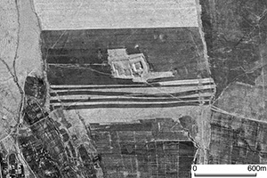
Kindik Tepa |
 |
 |
|
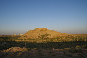
Mound of Nasaf Site |
 |
 |
|
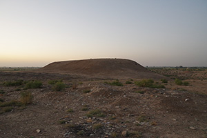
Citadel of Parcha Kala |
September 24 : Visited sites in the region along Kashkadarya River. Traveled eastward and stayed in Shakhrisabz.
 |
 |
|
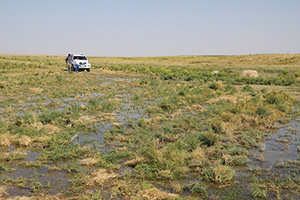
Small stream flowing north of Odirma Shahar |
 |
 |
|
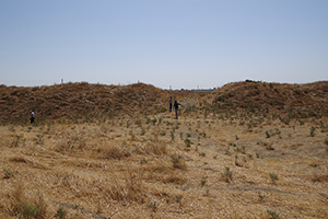
Northern gate of Odirma Shahar |
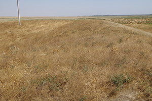 |
Inner enclosure of Odirma Shahar. | 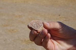 |
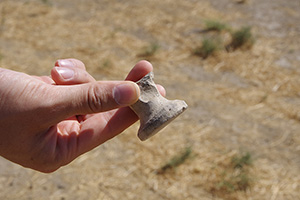
Ceramic piece found on the surface of Odirma Shahar |
 |
 |
|
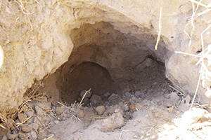
Ceramic pipe found beneath the surface of Odirma Shahar |
 |
 |
|
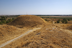
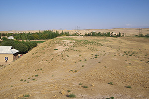
Mound of Khoja Buzrug |
 |
 |
|
Mound of Bobur Tepa |
 |
 |
|
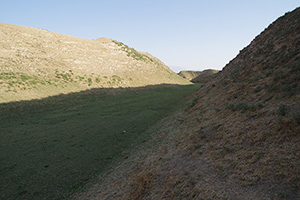
Western trench of Chimkurgan Tepa |
 |
 |
|
Southern trench of Chimkurgan Tepa |
September 25 : Visited Museum of Shakhrisabz, and took a look at Yumaloq Tepa. Traveled to Samarkand in the afternoon. September 26 : Visited the Archaeological Institute of Uzbekistan and Afrasiab Museum in Samarkand. Then we traveled to Tashkent. September 27 : Visited National Museum of History. In the evening we departed Tashkent to go home.
Created by Noboru Ogata
Since September 30, 2017
![]()