 |
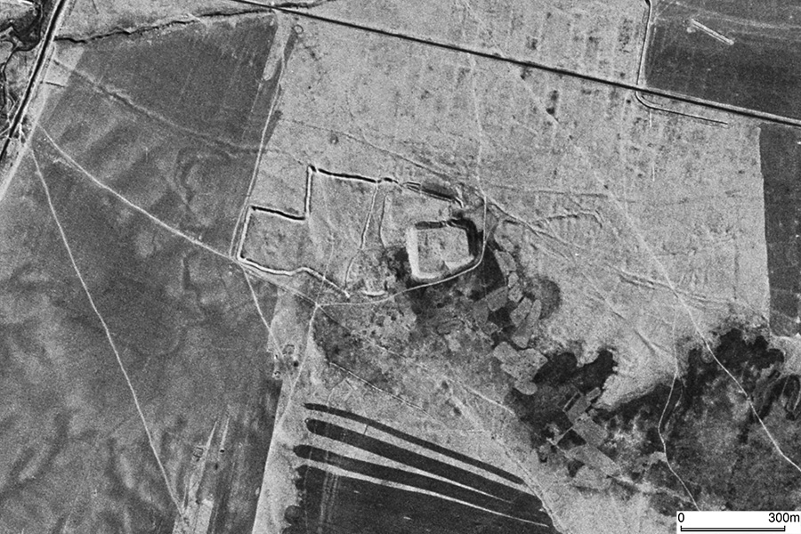
| CORONA Satellite Photograph over Komay Tepa (October 20, 1964). This site is composed of two mounds, namely the northwestern and southwestern ones. The southwestern mound is higher. We can see a mysterious enclosure surrounding the western area of the mounds. This feature might have nothing to do with the archaeological site, and disappeared today. |
CORONA satellite photographs are available from U. S. Geological Survey, EROS Data Center, Sioux Falls, SD, USA.