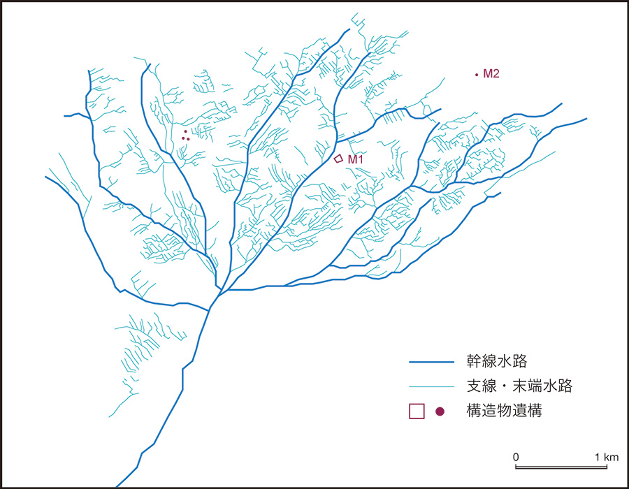
衛星画像から復原したミーラン遺跡の用水路網。QuickBird-2衛星画像(2005年10月31日撮影)から判読・抽出した。末端水路が等間隔・平行の櫛の歯状を呈することが,この遺跡の特徴である。このように衛星画像判読を通して線状の高まりを呈する古代の用水路跡を復原する方法は,相馬秀廣教授によって提案された。以下の文献をご覧ください。
- Sohma, H. (2003) Ruins of “Silk Road” in the nothwestern China, viewed from Corona Satellite Photographs; in cases of Lou-lan, Milan, and Turpan. In Proceedings of the Nara Symposium for Digital Silk Roads: December 10 -12, 2003, Nara-ken New Public Hall, Nara, Japan, pp. 299 -308.
- Hirohide SOHMA, Ran TIAN, Jien WEI, Kazuki MORIYA, Shinobu IGURO, Toshio ITO, Noboru OGATA (2011) An Idea for Ruins Research through Cooperation with Interpretation of the High-resolution Satellite Images, Archaeology, Historical Documents and Geography, Journal of Arid Land Studies(沙漠研究), 21 (2), pp. 45-49.