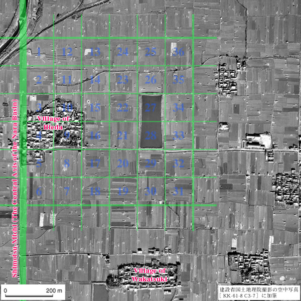
An aerial photo over Hieda Village in Yamato-Kôriyama City, overlaid by the restored
jôri
plan.
Clicking the image switches the display of the restored plan.
The photo was taken in 1961 by the Geographical Survey Institute of Japan (retouched).
Back