Noboru Ogata (Professor Emeritus, Kyoto University)
We made a field trip in the Ejina (Edsen-gol) Region in the Inner Mongolia Autonomous District, China in August 2007 as a part of our research project headed by Professor Hidehiro Sohma of Nara Women's University. Our research purpose is to locate remains of ancient frontier settlements and border-watching system using satellite imagery. The following is our record and pictures taken during the trip. Results of our research will be published in academic meetings or papers.
The study area is an oasis amid the Gobi Desert watered by Ejina River. The most famous archaeological feature in this area is Kharakhoto, city ruins from the periods of the Western Xia (Tangut) Kingdom and Yuan Dynasty (Mongol Empire). The site was explored in 1908 by P. K. Kozlov, a Russian explorer. The most comprehensive research was made in the Sino-Swedish Scientific Expedition to the Northwestern Provinces about 1930. In this project, archaeological researches in the Ejina Region were led by Folke Bergman, a Swedish archaeologist. From examination of unearthed wooden writing tablets from many archaeological sites, Ejina Region was identified with Juyan Region mentioned in the histories of Han China. Juyan Region was settled in this oasis by the Chinese as a military frontier against Xiongnu (the Huns), a nomadic tribe which ruled the Mongolian Plateau. Recent research results about unearthed written materials were compiled by Professor Wei Jian, an archaeologist at Renmin University of China.
From the satellite image on the right, we can see that there used to be an oasis in the desert stretching southeastward from today’s oasis. On the east side of the vanished oasis, we can see the remains of a larger lake, i. e. Juyan Lake mentioned in histories of the Han period.
We are very grateful to Dr. Wei Jian and Dr. Qi Wuyun (Assciate Professor at Institute of Archaeology, Chinese Academy of Social Sciences) who guided us during the research trip as a research partner of our project.
Professor Sohma passed away in August 2012. We pray for the repose of his soul.
Overview of the study area (Landsat imagery acquired on July 30, 1990)
References
- P. K. Kozlow (1925) Zur Tote Stadt Chara-Choto, Verlag Neufeld & Henius (German edition).
- B. Sommarström (1956•58) Archaeological Researches in the Edsen-gol Region Inner Mongolia, Part I and II, Statens Etnografiska Museum.
- H. Nagata (1989) A Diplomatic Study of Chü-yen Han Wooden Strips, Dôhôsha (in Japanese).
- Wei Jian (2005) Ejina Hanjian (Written materials of the Han period unearthed from Ejina), Guangxi Normal University Press (in Chinese) .
August 4 : Arrived in Beijing, met Dr. Wei, Dr. Qi and other teammates, and flew to Yinchuan. Stayed in Yinchuan.
August 5 : Traveled from Yinchuan to Dalai Khobbu, the main city of the Ejina Region. We stayed in Dalai Khobbu until August 10.
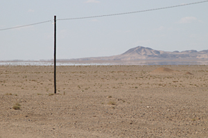
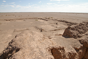
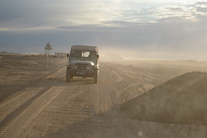
We traveled for a full day, but we saw very few settlements all through the route. The gobi landscape (gravel plain) streched as far as the eye can reach. Mirage was seen along the horizon. |
 |
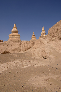
Forenoon of August 6 : Visited ruins of a watch-tower from the Western Han period, Datongcheng fort and Kharakhoto, the most prominent remains of walled cities in the region.
|
 |
|
Ruins of Datongcheng fort |
CORONA satellite photograph over the walled city ruins of Kharakhoto. It was taken on September 29, 1969. Marco Polo mentioned city of Etzina in the Tangut Province in his travel book in the 13th century. According to the geographical accounts included in the official history of the Yuan Dynasty, Yejinai was founded by the Western Xia Kingdom, and the Mongol Empire, which took over the city, established a governer's office there (Yuan-shi, Vol. 60). The mentioned city of Ejina might be identifiable with Kharakhoto site. In 1372, newly established Ming Dynasty of China dispatched troops to recover northwestern territories and during this process Yejinai was captured (Ming-shilu, fifth year of the Hongwu Era). It is suggested that after this event, Kharakhoto site and its surrounding area became gradually deserted. |
 |
|
Western wall and gate of Kharakhoto |
 |
Inside of the wall |
 |
|
Afternoon of August 6 : Visited walled ruins called Tsonjin-ama or coded as «A1». It is identified with the fort of “Tianbei Houguan” mentioned in unearthed wooden writing tablets.
 |
 |
|
Views from the top of the wall of «A1» |
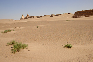
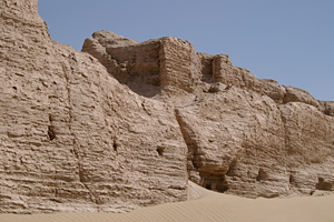
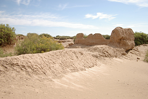
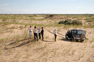
August 7 : Visited ruins coded as «K688» and «K710». These codes were given by Folke Bergman, a Swedish archaeologist, and his colleagues in the 1930’s. Those ruins are considered to have been local military and administrative bases of the Juyan region (present day Ejina region) in the Han period of China.
 |
 |
|
|
||
Many parts of the wall of «K688» are covered by tamarisk
cones. |
 |
|
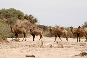 |
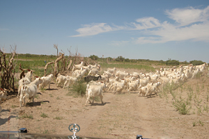
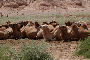
Pastured camels roaming nearby
|
 |
 |
|
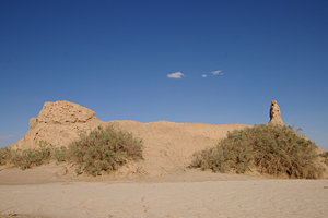
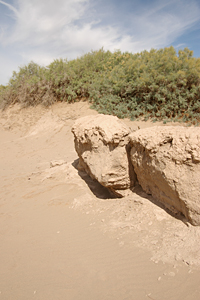
Overview of «K710» seen
from the top of a sand dune |
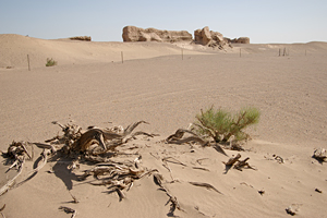
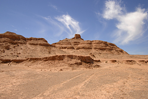
August 8 : Visited the ruins coded as «P1» or Boro-tsonji in the morning, and visited the ruins of «A8» or Muu-dorbeljin. «P1» is identified to “Sanshijing Houguan” and «A8» to “Jiaqu Houguan”, both mentioned in unearthed wooden writing tablets from the Han period of China.
 |
 |
|
Site of «P1» or Boro-tsonji |
 |
 |
|
Domesticated camels of a farm |
 |
 |
|
Ruins of «A8» or Muu-dorbeljin |
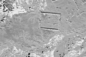
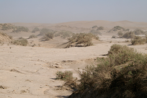
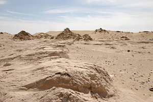
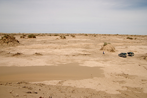
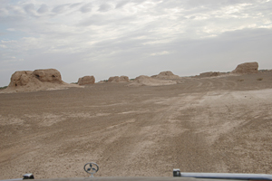
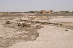
August 9 : Visited the ruins called 'Lucheng'. This site is a complex composed of various types of remains including ancient city walls, tombs and irrigation canals.
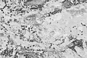
CORONA satellite photograph over the Lucheng site taken on September 29, 1969. You can find the oval enclosure of Lucheng city ruins on the satellite photograph. According to Prof. Wei's explanation, remains of the city wall date back to the Han period or even earlier. We saw many tombs and debris of artifacts in the surrounding area. The most prominent feature observable in the satellite photograph and on the ground is the network of irrigation canals, indicating that agriculture based on the irrigation system once carried on. However, because of the subsquent change in the environment, this area is mostly uninhabitable desert today. |
 |
 |
 |
|
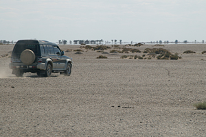
Driving around the Lucheng site. Major
visible remains are ancient tombs. |
 |
|
 |
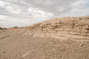
Remains of irrigation canals |
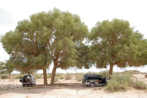
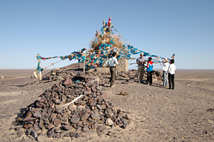
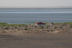
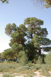
August 10 : Visited Sogo-nuur, the terminal lake of Ejina River, and Boro-oboo, a sacred place for Tibetan Buddhism. We saw poplar forests along the route.
 |
 |
|
Sogo-nuur viewed from the site of
Boro-oboo |
 |
 |
|
|
||
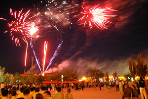
In the evening, an event
celebrating the 60th anniversary of the foundation of Inner Mongolia
Autonomous Region was held in Dalai Khobbu. |
August 11 : Departed Dalai Khobbu to Yinchuan, then flew to Beijing. Stayed in Beijing.
August 12 : Departed Beijing to Japan.
Created by Noboru Ogata
Since 05/Apr/2008 : Updated 28/Aug/2014
![]()
![]()
