|
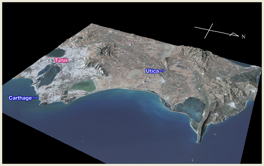
| Bird’s eye view showing the location of Utica with relation to Carthage. Elevation is exaggerated by four-fold. In ancient times, Utica was a seaport town at the tip of a peninsula near the mouth of Mejerda River. The sea, once gave access to the seaport town was piled up by the sedimentation of Mejerda River, and Utica was declined since its port fell dysfunctional. Today, town ruins of Utica is located inland. This view is made up through combining SRTM geomorphological data and LANDSAT ETM+ satellite image taken on May 26, 2005. |
Photographed by Noboru Ogata (2009)