In this webpage, we offer the records taken during our research trip in Tunisia in November 2009. The research trip was made as a part of our research project headed by Professor Takura Izumi of Kyoto University. We visited around the Punic and Roman sites including Carthage, Utica, Kerkouane and others. These ancient towns were under Carthaginian rule during the Punic period. As usual for the Phoenician colonies, some of these sites were seaport towns, while others were located inland.
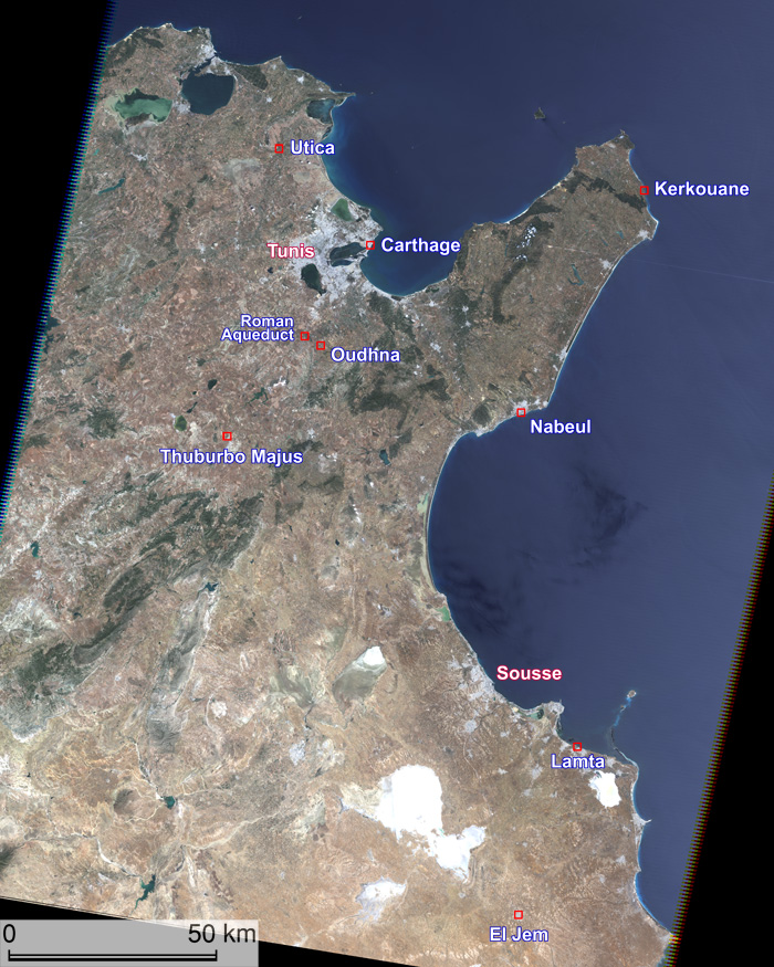
Carthage, a seaport town, is considered to be founded early in the 1st millennium BCE by the refugees from Tyre, Phoenicia (modern Lebanon). Being the relay point between Phoenicia and the western part of the Mediterranean, it began to grow after 6th century BCE and formed a maritime empire. Different from other Phoenician colonies, the Carthaginian were also active in land cultivation and founded inland towns. From 3rd to 2nd century BCE, Carthage was defeated and destroyed by the Romans in the Punic War. After the 1st century BCE, however, Carthage and other Punic towns recovered prosperity under the Roman rule.
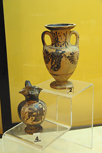
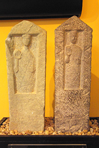
We saw magnificent colored mosaic pictures in museums. The amphitheater in El Jem is really colossal. But these artifacts are from the Roman era. Settlement remains from Punic era, although we have only limited examples to see, are generally smaller and simpler when compared to those from Roman era. Artifacts from the Punic era include potteries, coffins, and steles with inscriptions. Kerkouane, a settlement ruins on the coast of Cap Bon peninsula, is a precious example of Punic sites without impacts of the subsequent Roman culture, and listed in the UNESCO World Heritage Sites.
My task in our project is to examine the location and plan of Punic and Roman towns in the study area using satellite images. Phoenician towns are generally considered to have been seaport towns specialized to marine trade. As for Punic towns within the domain of Carthage, however, this generalization does not seem to apply. Moreover, many Punic towns, except for Kerkouane, were influenced by constructing activities in the Roman era. Therefore, my research scope should be focused on extracting Punic features from the settlement remains.
[References]
- G. C. Picard and C. Picard, translated by D. Collon, Carthage: A Survey of Punic History and Culture from its Birth to the Final Tragedy, Sidgwick & Jackson, 1987.
- S. Lancel, translated by A. Nevill, Carthage: A History, Blackwell, 1995.
- G. E. Markoe, Phoenicians, University of California Press, 2000.
 |
| Synoptic view over the study area using LANDSAT image (ETM+ : May 26, 2005) |
November 13 : Flew from Osaka to Tunis via Paris.
November 14 : Made a field trip around Carthage including Museum of Carthage at Acropolis of Byrsa. Carthage is located in the northeastern suburbs of Tunis.
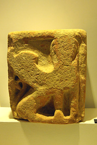
 |
 |
|
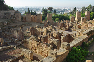
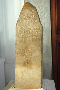
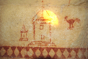
The sign of Tanit inscribed
on a stele. Tanit was one of the most important goddesses in the ancient
Phoenician and Punic world. Museum of Carthage |
 |
 |
|
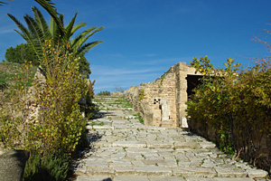
So called ‘Roman
villas’
including remains of streets and buildings |
 |
 |
|
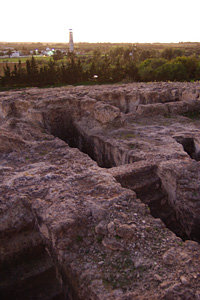
Military harbor of Carthage,
having circular shape |
 |
 |
|
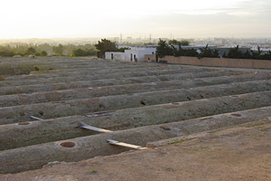
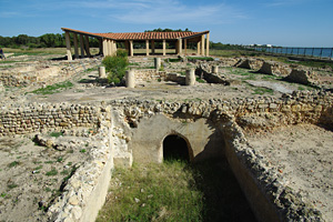
Cistern of la Malga |
 |
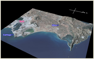
| Bird’s eye view showing the location of Carthage. Elevation is exaggerated by four-fold. In ancient times, Carthage was located near the tip of an arrow shaped peninsula. The sea, once encircled the peninsula is now partly filled up. |
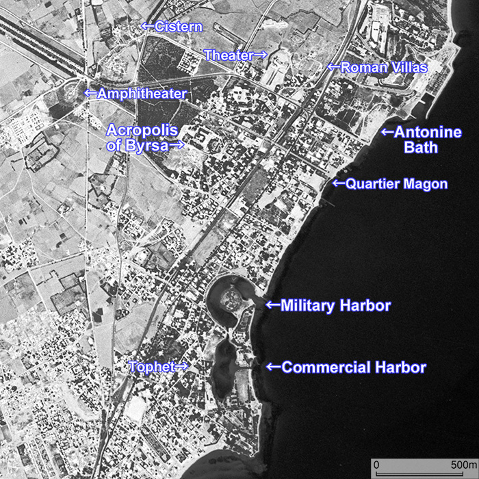 |
CORONA satellite photograph over Carthage taken on May 31, 1972. You can observe the curious shape of the military harbor and the commercial harbor on the image. Photo available from U. S. Geological Survey |
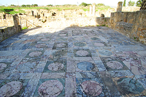
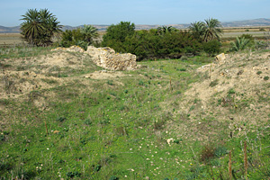
November 11, forenoon : Visited Utica Museum and the town remains of Utica. Founded as a Phoenician colony prior to Carthage, Utica was once a seaport town, and enjoyed prosperity during the Punic and Roman eras. After the sedimentation of Mejerda River piled up its port, Utica was abandoned and it is inland ruins today.
 |
 |
|
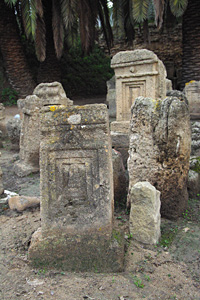
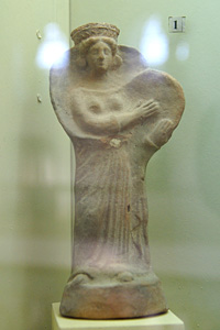
Stelae of Punic style.
3rd – 2nd century BCE. Utica Museum |
 |
 |
|
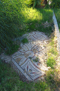
Tiled floor of Maison de la Cascade |
 |
 |
|
Entrance of Maison des Chapiteaux
Historiés |
 |
 |
|
View of the plain, which
once was the sea, from the tip of peninsular highland |
 |
 |
|
Colored by elevation |
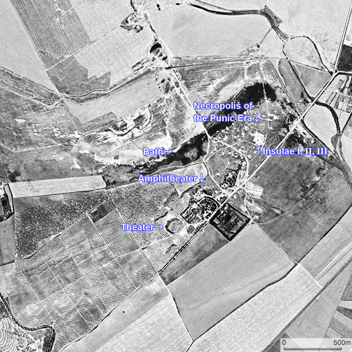 |
CORONA satellite photograph over the trown remains of Utica taken on May 31, 1972. The town was located at the tip of a peninsular highland extending from the southwest to the northeast. Surrounding plain was once the sea, and Utica prospered as a seaport town. Photo available from U. S. Geological Survey |
November 15, afternoon : Visited Bardo Museum in Tunis.
 |
 |
|
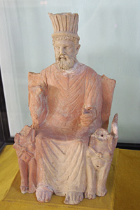
Image of Baal Hammon,
the most important divinity in the Punic world |
 |
 |
|
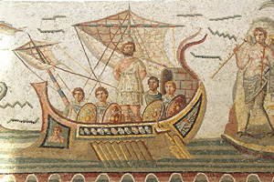
Mosaic picture depicting
Ulysses on a ship |
November 16 : On this day, we traveled around Cap Bon peninsula. We visited Nabeul, Kelibia, Kerkouane, El Haouaria and then returned to Tunis.
 |
 |
|
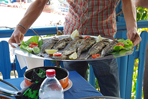
Lunch at Kelibia |
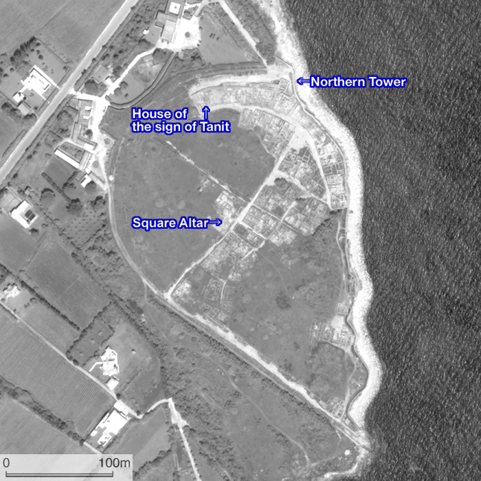
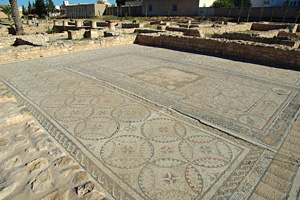
At 14:50, we arrived at the town remains of Kerkouane. Kerkouane was a Punic town that was abandoned circa 3rd century BCE. It is a precious archaeological site in that it was not influenced by the Roman buildings and inhabitation. Accordingly, it was listed on the UNESCO World Heritage Sites in 1985. We also visited the necropolis (cemetery) of the town located in the suburbs.
 |
 |
|
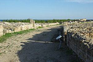
Street drawing an arc |
 |
 |
|
Remains of an altar |
 |
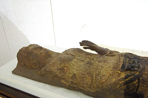 |
|
Image of a woman carved
on a wooden coffin |
 |
 |
|
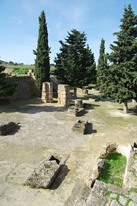
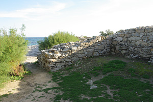
Necropolis near Kerkouane |
 |
WorldView-1 satellite image over Kerkouane taken on June 4, 2009. We can observe that Kerkouane was a small town having a circular shape. © DigitalGlobe / Hitachi Solutions |
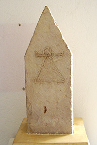
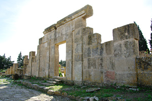
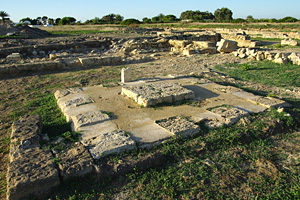
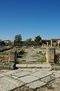
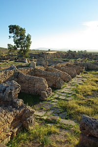
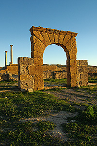
November 17, forenoon : Visited an inland site Oudhna (classical name : Uthina), then viewed Roman aqueduct of Zaghouan.
 |
 |
|
Landscape viewed from
the Capitol |
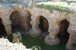 |
 |
|
The amphitheater at Oudhna |
 |
 |
|
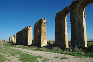
Roman aqueduct of Zaghouan |
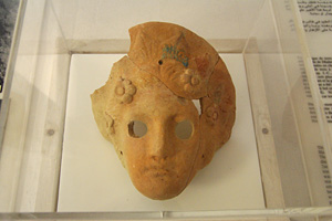
November 17, afternoon : Traveled southward and visited Lamta (classical name : Leptis Minor) and its museum. Stayed in Sousse.
 |
 |
|
Terra cotta mask |
 |
 |
|
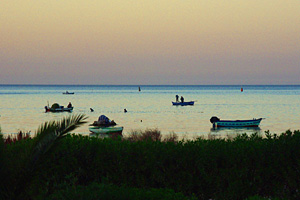
View from a seaside tea
house at Lamta |
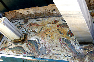
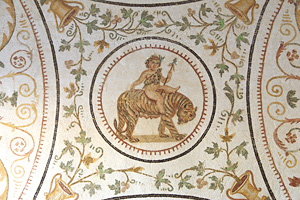
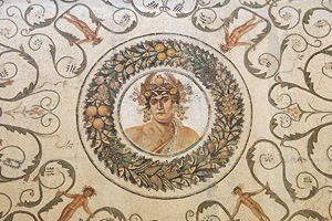
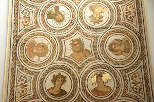
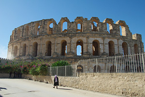
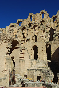
November 18, forenoon : Traveled from Sousse southward to reach El Jem (classical name : Thysdrus). At the museum here, we saw many magnificent mosaic pictures. Then we visited the amphitheater, which is so huge that it may be called Colosseum.
 |
 |
|
Mosaic picture depicting infant Dionysus |
 |
 |
|
Mosaic picture depicting Aeon and
other divinities |
 |
 |
|
Remains of a residence
viewed from the entrance |
 |
 |
|
The amphitheater of El Jem.
Yes, it's colossal. |
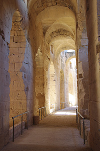
||
Looking up the structure
of the amphitheater of El Jem |
 |
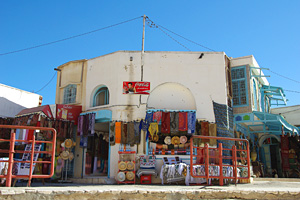 |
|
Souvenir shop next to
the amphitheater |
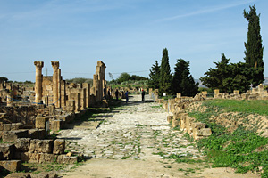
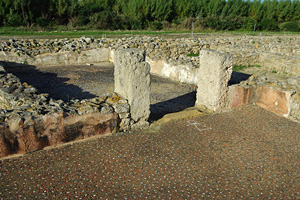
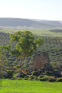
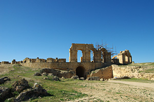
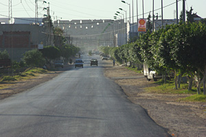
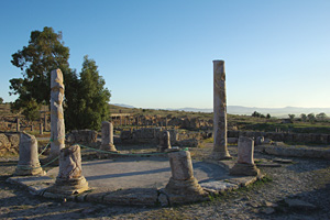
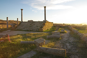
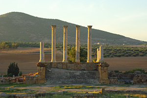
November 18, afternoon : Visited the town remains of Thuburbo Majus. Then came back to Tunis and stayed there.
 |
 |
|
Temple of Mercury |
 |
 |
|
Temple of the goddess
Baalat |
 |
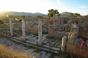 |
|
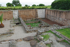
Remains of residences at Thuburbo
Majus |
 |
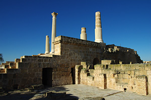
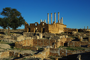
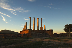 |
|
The Capitol in the setting sunlight |
November 19 : Departed Tunis in the early morning and flew back to Osaka via Paris. We arrived at Osaka in the morning of November 20.
Created by Noboru Ogata
Since November 4, 2010 : Updated March 25, 2016
![]()
![]()