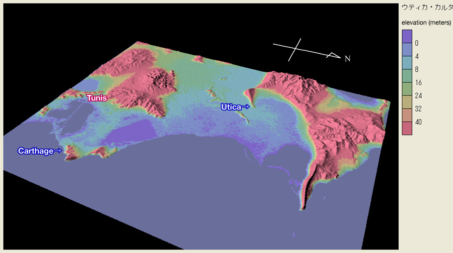
Bird’s eye view of the area including Carthage and Utica colored by elevation. You can observe that town ruins of Utica is located at the tip of peninsular highland encircled by the lowland. This lowland was once the sea, and Utica was a seaport town. This visualization is made from SRTM elevation data.