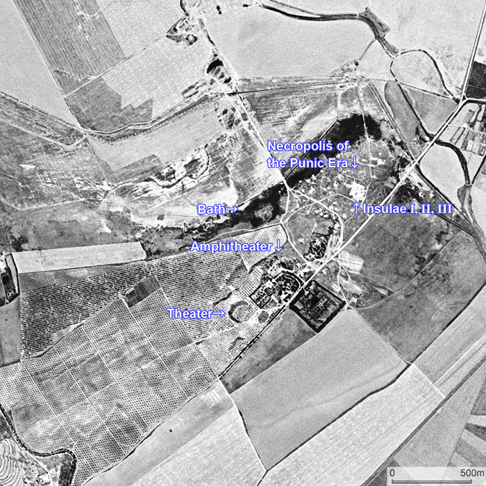
CORONA satellite photograph over Utica taken on May 31, 1972. It was located at the tip of a peninsular highland extending from the southwest to the northeast. Surrounding plain was once the sea, and Utica prospered as a seaport town. Insulae I, II, III are excavated town remains of the Roman era which include luxurious residences.