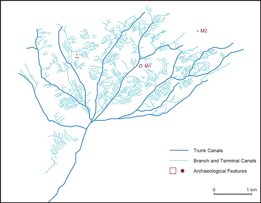
Restored networks of ancient irrigation canals of the Miran Settlement Ruins through interpreting QuickBird-2 satellte image (2005/10/31). The remarkable characteristic of this site is the pattern of evenly spaced and parallely running terminal canals. The idea of identifying ancient networks of irrigation canals through inspection of the satellite imagery was presented by Professor Hidehiro Sohma. Please see the following articles.
- Sohma, H. (2003) Ruins of “Silk Road” in the nothwestern China, viewed from Corona Satellite Photographs; in cases of Lou-lan, Milan, and Turpan. In Proceedings of the Nara Symposium for Digital Silk Roads: December 10 -12, 2003, Nara-ken New Public Hall, Nara, Japan, pp. 299 -308.
- Hirohide SOHMA, Ran TIAN, Jien WEI, Kazuki MORIYA, Shinobu IGURO, Toshio ITO, Noboru OGATA (2011) An Idea for Ruins Research through Cooperation with Interpretation of the High-resolution Satellite Images, Archaeology, Historical Documents and Geography, Journal of Arid Land Studies, 21 (2), pp. 45-49.