![]()
Noboru Ogata (Professor Emeritus, Kyoto University)
We made a field trip in and around the Tarim Basin, Xinjiang Uygur Autonomous Region, China in August 2005 as a part of our research project. Our research purpose is to locate remains of ancient settlements along the Silk Road using satellite imagery. We greatly appreciate the cooperation of Dr. Yu Zhiyong and other researchers of Xinjiang Institute of Cultural Relics and Archaeology. The following is our records and research results of the trip. Part of our research results is published in the following paper.
Professor Sohma, the leader of our research project, passed away in August 2012. We pray for the repose of his soul.
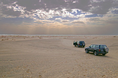
August 12 : Traveled from Wulumuqi to Korla.
 |
 |
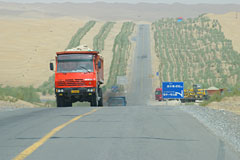
|
Mountain road between Yanqi and Korla |
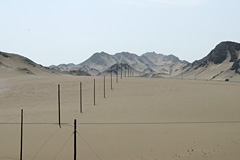
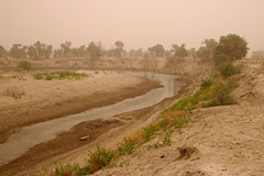
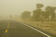
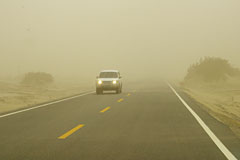
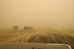
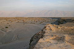
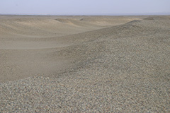
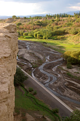
August 13 : Traveled from Korla to Miran traversing the eastern edge of the Tarim Basin.
 |
 |
|
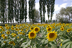
Typical landscape of settlements in
the oases |
 |
 |
|
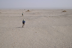
Poplar trees in sandstorm |
 |
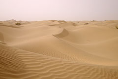
 |
|
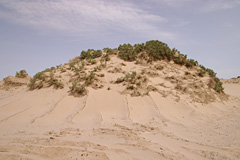
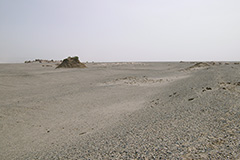
Sand ripples in the wind |
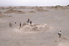
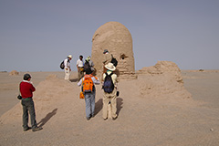
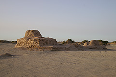
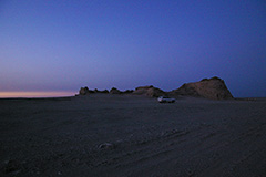
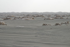
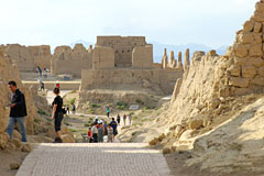
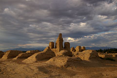
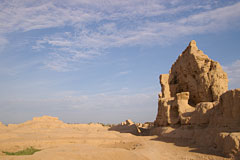
August 14 : Made research on the Miran Settlement Ruins.
 |
 |
|
«M13» feature, a watchtower, in the Miran Settlement Ruins |
 |
 |
|
«M7» feature, a Buddhist stupa, in the Miran Settlement Ruins |
 |
 |
|
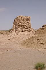
«M4» feature, a Buddhist monastery, in the Miran Settlement Ruins |
 |
 |
|
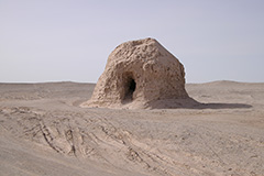
«M1» feature, a Tibetan fort, in the Miran Settlement Ruins in the twilight |
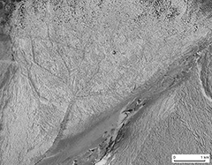
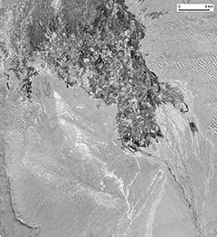
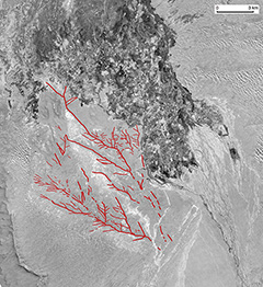
Based on Professor Sohma’s study, it was made clear that we can observe ancient irrigation networks of the Miran Settlement Ruins on satellite images. It is also obvious that ancient human activities of cultivation and irrigation are reflected on landform of the site.
 |
 |
|
Restored networks of ancient irrigation canals |
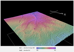
|
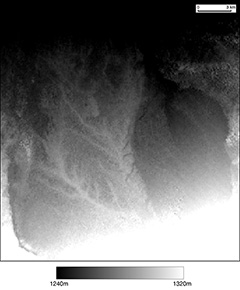
Geomorphological model of the Miran Settlement Ruins based on AW3D data |
 |
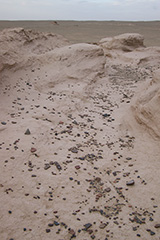
August 15 : After making research on the Miran Settlement Remains, we traveled to Ruoqiang (Charkhlik).
 |
 |
|
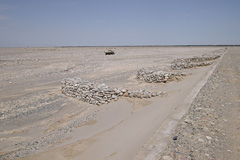
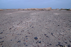
Remains of ancient canals which take the form of linear ridges in the Miran Settlement Ruins |
 |
 |
|
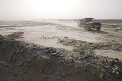
Route from Miran to Ruochang crossing a dry riverbed |
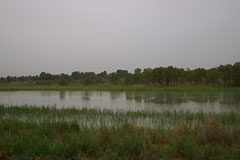
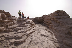
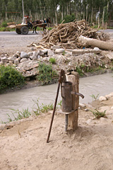
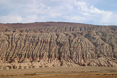
August 16 : Visited ruins near Rouqiang.
 |
 |
|
Edge of the fluvial terrace near Ruoqiang |
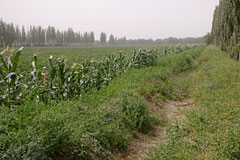
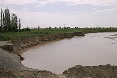
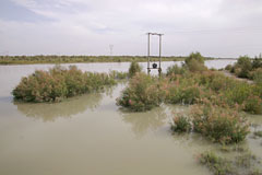
August 17 : Traveled from Ruoqiang to Qiemo (Cherchen). In the afternoon, after visiting Zaghunluk Cemetery Area, we inspected remains of an irrigation canal in the Qiemo Settlement Ruins.
 |
 |
|
Cherchen River with its bank destroyed
by the risen water |
 |
 |
|
Qiemo (Cherchen) Settlement Ruins |
 |
 |
|
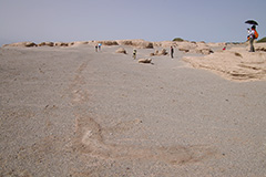
Remains of an irrigation canal in the Qiemo Settlement Remains |
 |
 |
|
‘Tati’ landscape of the Qiemo Settlement Ruins |
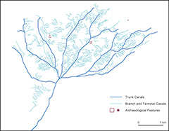
After returning home, we inspected satellite imagery and geomorphological data, and identified networks of ancient irrigation canals.
 |
 |
|
Restored networks of ancient irrigation canals |
|
Geomorphological features of the Qiemo Settlement Ruins visualized using SRTM data |
 |
August 18 : Traveled from Qiemo to Luntai traversing the Taklamakan Desert.
 |
 |
|
The Tarim Desert Highway and paralleling shelterbelts |
 |
 |
|
Lunch in a market town near the Tarim
River Bridge |
August 19 : Traveled from Luntai to Turpan. Visited Jiaohe City Ruins near Turpan in the afternoon.
 |
 |
|
Precipitous cliffs encircling the Jiaohe
City Ruins |
 |
 |
|
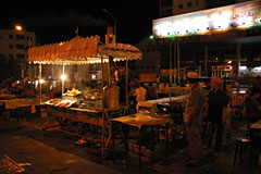
Evening bazaar in Turpan |
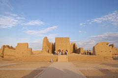
August 20 : Visited Gaochang city ruins and Huoyanshan then traveled to Beijing via Wulumuqi.
 |
 |
|
Northern part of the city wall, Gaochang
City Ruins |
|
Huoyanshan (Flaming Mountains) in the north of the
Gaochang oasis |
 |
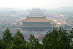
August 21 : Traveled from Beijing home.
|
The Forbidden City of Beijing |
 |
Created by Noboru Ogata
Since 01/Aug/2006 : Updated 21/Feb/2018
![]()
![]()