 |
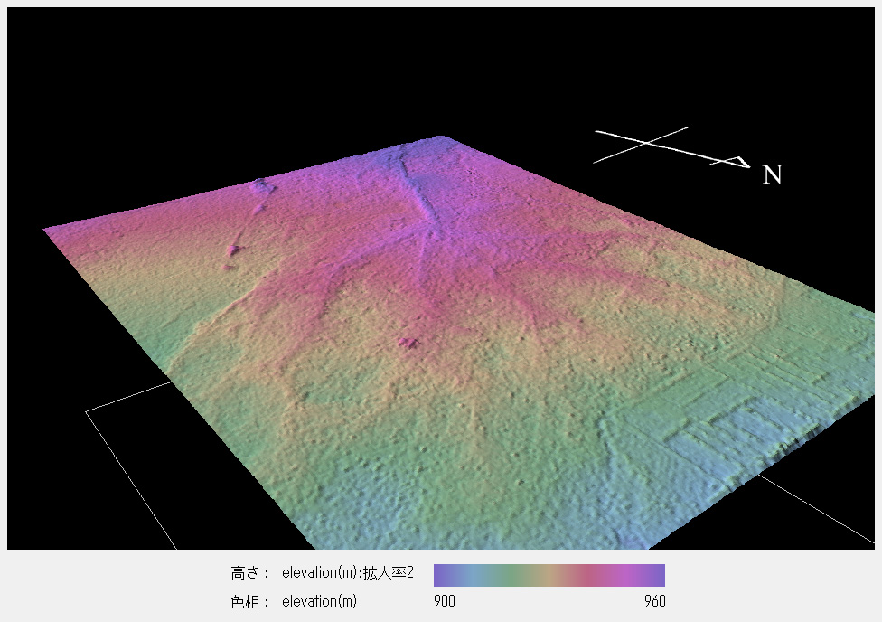
| Geomorphological model of the Miran Settlement Ruins using AW3D® data. You can observe the linear ridges along the trunk canal remains, which form a radial pattern. This seems to be the result of human activity of cultivation and irrigation for centuries. |
AW3D® topographic data are created based on the observation of Japan’s satellite DAICHI operated by JAXA.