| |
|
|
|
|
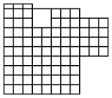
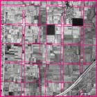
The palace site in the center of the north side of the city included the Imperial Palace and government offices. There were two official marketplaces, one each located in the Left and the Right City. Near the palace site, remains of large plots for nobles’ residences have been discovered. These residences sometimes occupied several tsubo. Away from the palace site, each tsubo was divided into smaller plots to provide living quarters for the common people. Nara was abandoned as a capital in 784, and most of its area reverted to rice paddies. The above aerial photo, taken in 1961, is of the central area of Heijō-Kyō, where the ancient plan is well preserved. It shows traces of the old grid pattern in the rectangular reservoirs and the paths between rice fields.
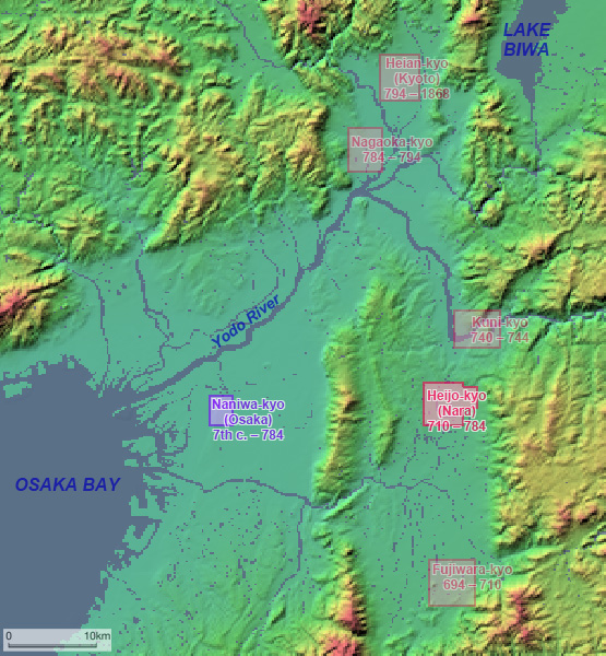
Gekyō, the Outer City, had been added to the northeast side of the city. Major Buddhist monasteries such as Kōfuku-ji and Gangō-ji were situated there, and Tōdai-ji, which is famous for its enormous statue of Buddha, was built adjacent to the area. Due to the influence of these monasteries, this part of the city remained an urban settlement after the capital was moved to Nagaoka-Kyō and later to Heian-Kyō (Kyoto). Gekyō is the core of today’s Nara City. The other ancient capitals of Japan, such as Fujiwara-Kyō (694-710) and Heian-Kyō (794-1868), also adopted grid-pattern planning. This Chinese planning system was widely shared by the East Asian states of the time.
By Kumiko Yamachika, National Defense Academy
![]()